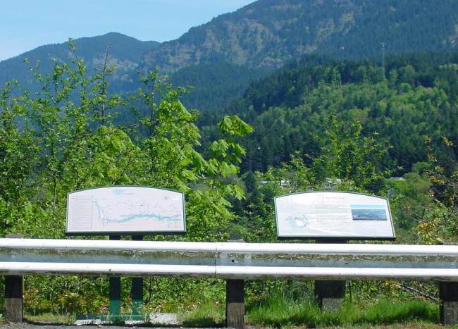
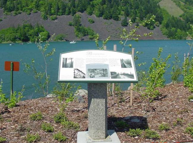
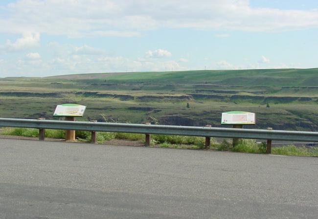
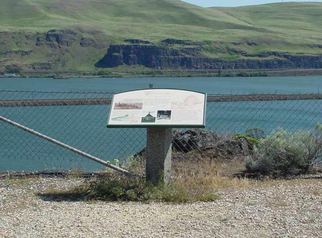
Historical highway markers
You can find interpretive historical highway markers along state highways and scenic byways throughout Washington. Use the map and list on this page to find marker locations.
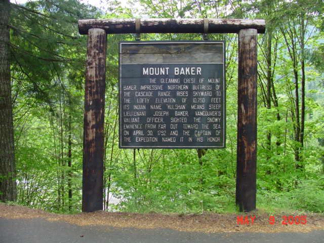
Marker 1
Mount Baker
Location: SR 542, Eastbound about 3.5 miles west of Glacier
Scenic Byway: Mt. Baker Scenic Byway
Image not available
Marker 2
David Douglas
Location: SR 20 In Rockport State Park
Scenic Byway: North Cascades Scenic Byway
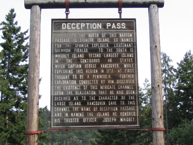
Marker 3
Deception Pass
Location: SR 20 Southbound at the south end of Deception Pass Bridge
Scenic Byway: Whidbey Scenic Isle Way
Image not available
Marker 4
Big Cedar Stump / Smokey Point
Location: I-5 Northbound in Smokey Point Safety Rest Area about 11 miles north of Everett
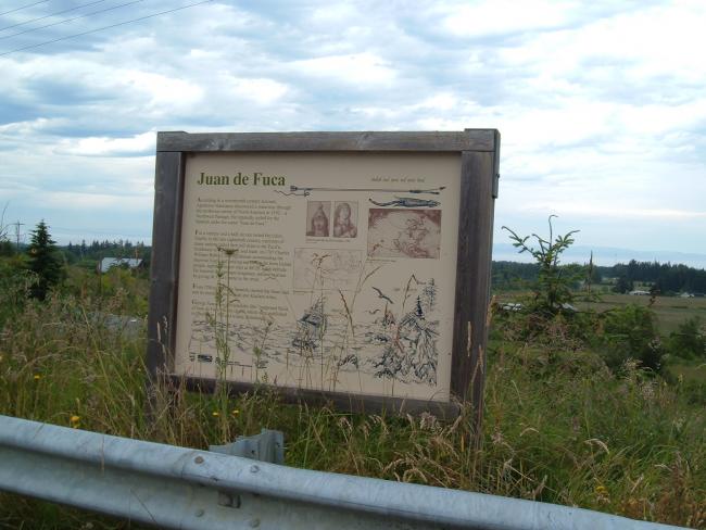
Marker 5
Juan de Fuca
Location: US 101 Westbound about 2-1/2 miles west of Port Angeles
Scenic Byway: Pacific Coast Scenic Byway
Marker 6
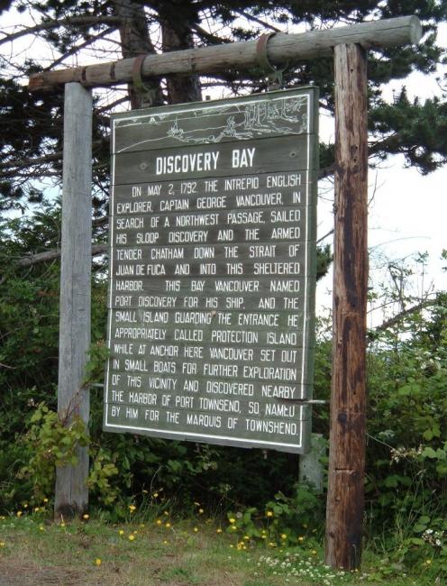
Discovery Bay
Location: US 101 Westbound about 2 miles west of Gardiner Scenic Byway: Pacific Coast Scenic Byway
Marker 7
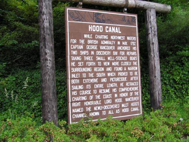
Hood Canal
Location: SR 106 Eastbound in Union
Marker 8
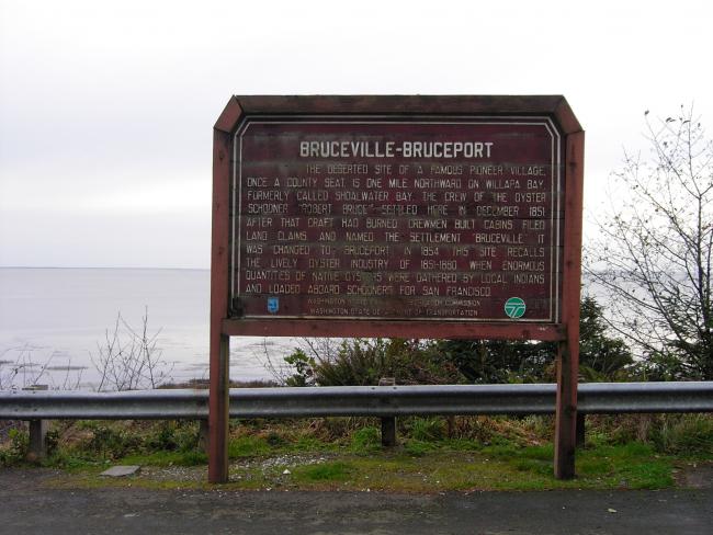
Bruceville / Bruceport
Location: US 101 Westbound about 6-1/2 miles south of South Bend
Scenic Byway: Pacific Coast Scenic Byway
Marker 9
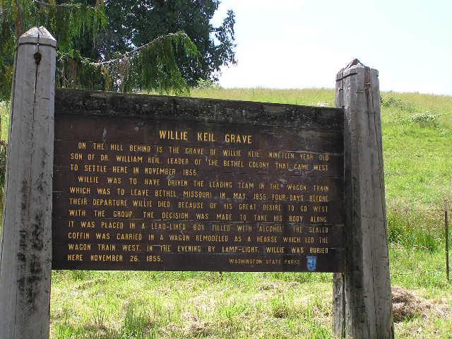
Willie Keil's Grave
Location: SR 6 Eastbound about 3 miles east of Raymond
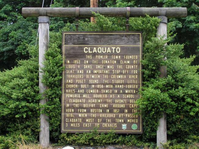
Marker 10
Claquato
Location: SR 6 Westbound about 2 miles west of I-5

Marker 11
Fort Columbia
Location: US 101 Southbound about 1 mile south of Chinook
Scenic Byway: Pacific Coast Scenic Byway
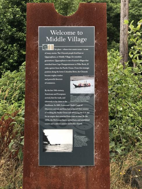
Marker 12
Middle Village, Station Camp
Location: US 101 Southbound, 1.5 miles south of Chinook at Station Camp
Scenic Byway: Pacific Coast Scenic Byway
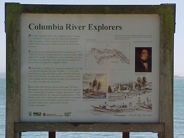
Marker 13
Columbia River Explorers
Location: US 101 Southbound 1 mile north of the Megler Astoria Bridge
Scenic Byway: Pacific Coast Scenic Byway
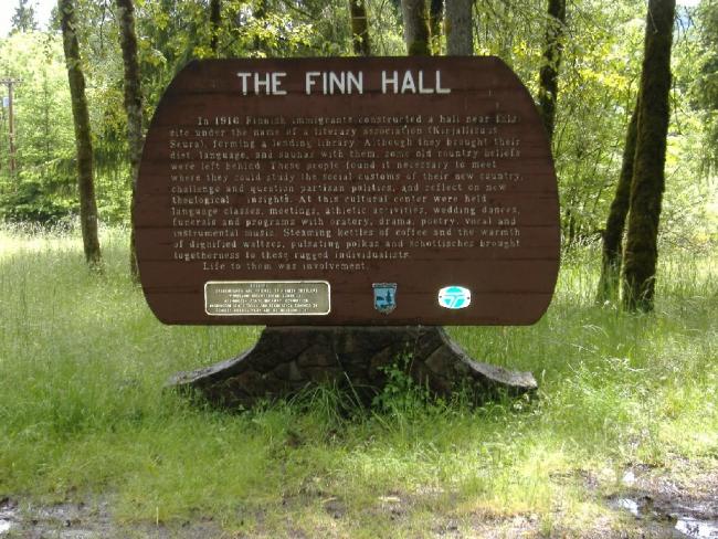
Marker 14
Finn Hall
Location: SR 503 Northbound about 2 miles north of Woodland
Marker 15
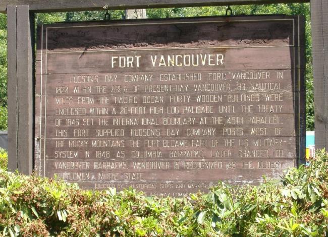
Fort Vancouver
Location: I-5 Northbound in Gee Creek Safety Rest Area
Marker 16
First Explorers
Location: SR 14 Eastbound in Washougal
Scenic Byway: Lewis & Clark Trail Highways
Marker 17
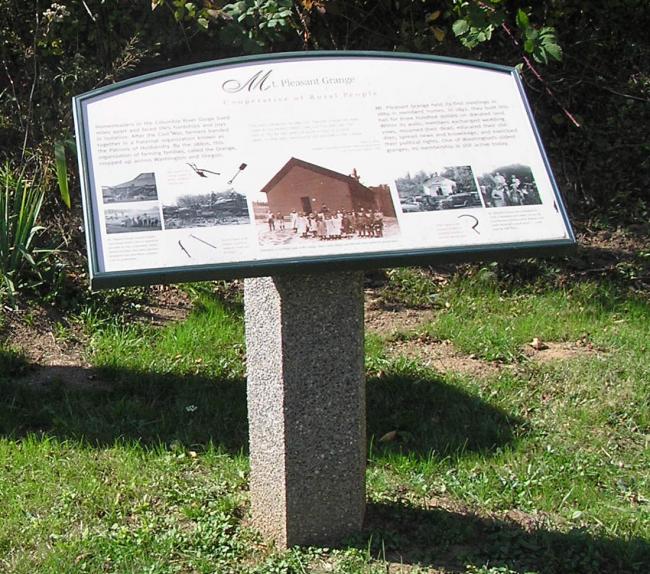
Mount Pleasant Grange Hall
Location: SR 14 Westbound about 4 miles east of Washougal
Scenic Byway: Columbia River Gorge
Marker 18
Golden Spike Ceremony
Location: SR 14 Eastbound about 1 mile east of North Bonneville Scenic Byway: Columbia River Gorge
Marker 19
Bridge of the Gods
Location: SR 14 Eastbound about 2 miles east of North Bonneville
Scenic Byway: Columbia River Gorge
Marker 20
Broughton Flume
Location: SR 14 Westbound about 7 miles west of White Salmon
Scenic Byway: Columbia River Gorge
Marker 21
Celilo Falls
Location: SR 14 Eastbound about 1 mile east of Wishram Heights
Scenic Byway: Columbia River Gorge
Marker 22
A Culture Lives On
Location: SR 14 Eastbound about 5 miles west of Wishram Heights
Scenic Byway: Columbia River Gorge
Marker 23
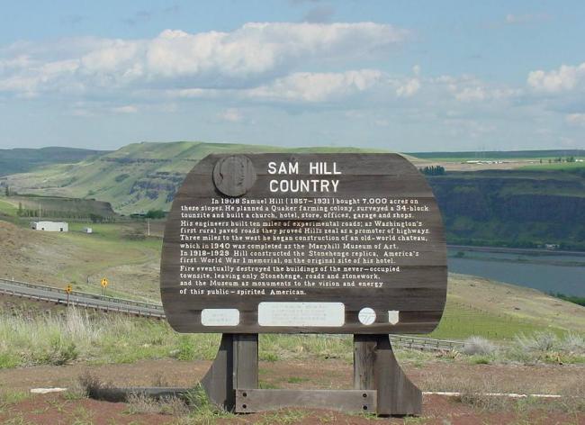
Sam Hill Country
Location: SR 14 Eastbound at the junction of US 97
Scenic Byway: Columbia River Gorge
Marker 24
Beck Memorial
Location: SR 821 Southbound mid way through Yakima River Canyon
Scenic Byway: Yakima River Canyon
Marker 25
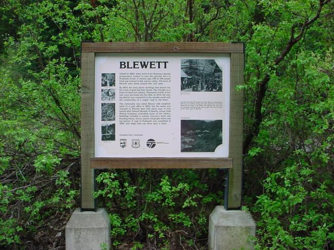
Blewett
Location: SR 97 Northbound about 11 miles south of the junction of US 2
Marker 26
Location: SR 97 Alternate Southbound in the town of
Scenic Byway: Entiat Cascade Loop
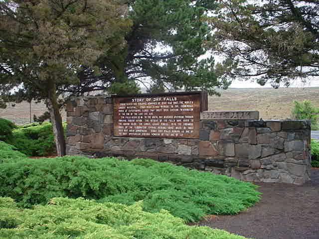
Marker 27
Dry Falls
Location: SR 17 Northbound about 4 miles south of the junction of US 2
Scenic Byway: Coulee Corridor
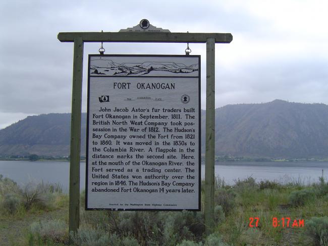
Marker 28
Fort Okanogan
Location: SR 97 Northbound about 2 miles north of Brewster
Scenic Byway: Okanogan Trail Scenic Byway
Marker 29
Location: SR 20 Northbound about 33 miles north of Newport
Scenic Byway: International Selkirk Loop
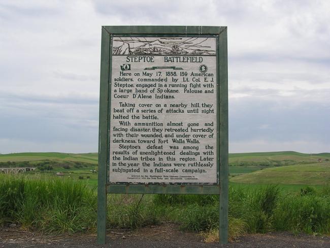
Marker 30
Steptoe Battlefield
Location: SR 195 Southbound in the city of Rosalia
Scenic Byway: Palouse Scenic Byway
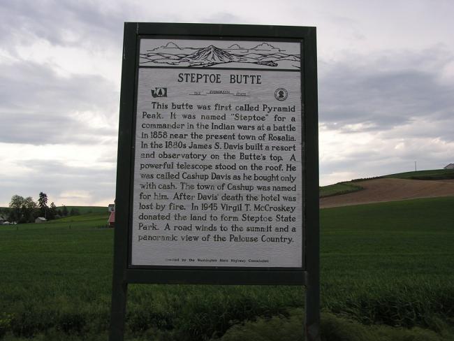
Marker 31
Steptoe Butte
Location: SR 195 Northbound at Steptoe
Scenic Byway: Palouse Scenic Byway
Marker 32
Kamiak Butte
Location: SR 27 Southbound about 10 miles north of Pullman
Scenic Byway: Palouse Scenic Byway
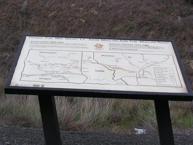
Marker 33
Mullan Road
Location: SR 26 Eastbound about 3 miles east of Washtucna
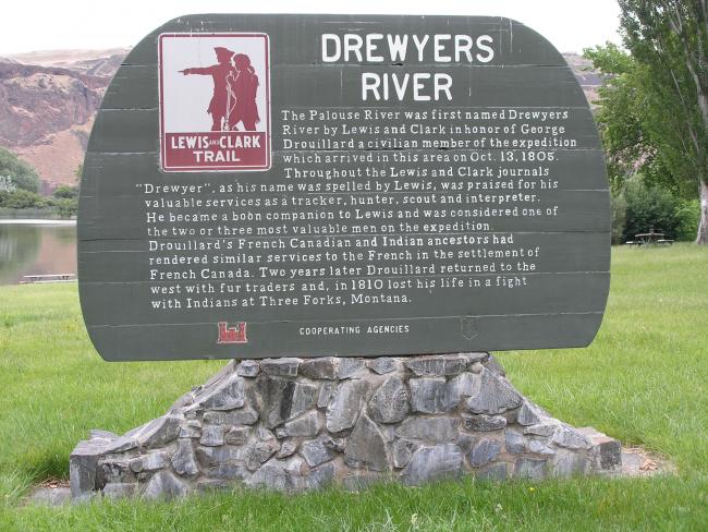
Marker 34
Drewyers River
Location: SR 261 Northbound in Lyons Ferry State Park
Marker 35
Lewis and Clark Alpowa Summit
Location: SR 12 Eastbound about 20 miles west of Clarkston in the Alpowa Summit Safety Rest Area
Scenic Byway: Lewis & Clark Trail Highways
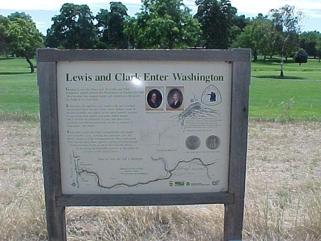
Marker 36
Lewis and Clark Enter Washington
Location: SR 12 Eastbound about 1-1/2 miles west of Clarkston
Scenic Byway: Lewis & Clark Trail Highways
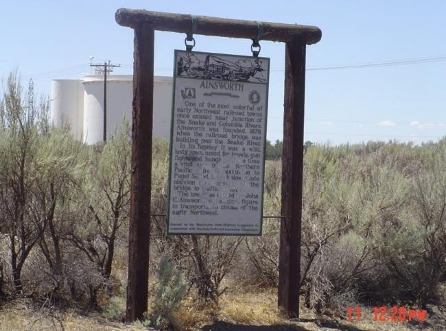
Marker 37
Ainsworth
Location: SR 12 Eastbound near Sacajawea State Park in Pasco
Scenic Byway: Lewis & Clark Trail Highways
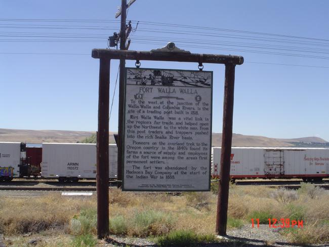
Marker 38
Fort Walla Walla
Location: SR 12 Eastbound about 12 miles south of Pasco, near the junction of SR 730
Scenic Byway: Lewis & Clark Trail Highways
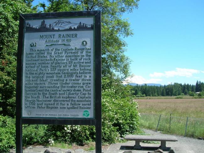
Marker 39
Mount Rainier
Location: SR 161 Northbound about 1-1/2 miles north of Eatonville
Marker 40
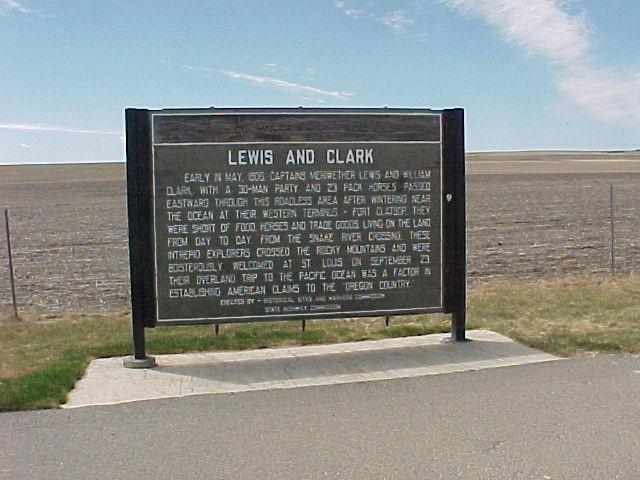
Lewis and Clark Trail
Location: SR 12 In Lewis & Clark Trail State Park
Scenic Byway: Lewis & Clark Trail Highways
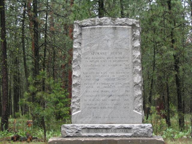
Marker 41
Spokane House
Location: SR 291 Northbound about 10 miles north of Spokane
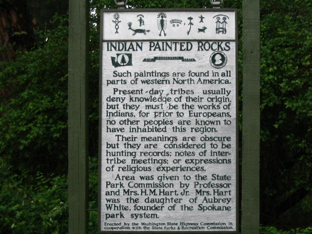
Marker 42
Indian Painted Rocks
Location: SR 291 Eastbound in riverside State Park
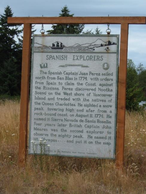
Marker 43
Spanish Explorers
Location: US 101 Westbound about 7 miles east of Port Angeles
Scenic Byway: Pacific Coast Scenic Byway
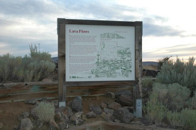
Marker 44
Lava Flows
Location: I-90 Eastbound in Ryegrass Safety Rest Area about 15 miles east of Ellensburg
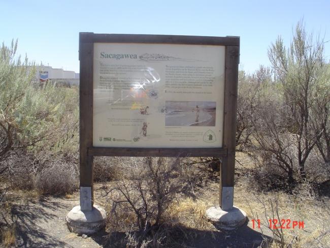
Marker 45
Sacajawea
Location: SR 12 Eastbound near Sacajawea State Park in Pasco
Scenic Byway: Lewis & Clark Trail Highways
Marker 46
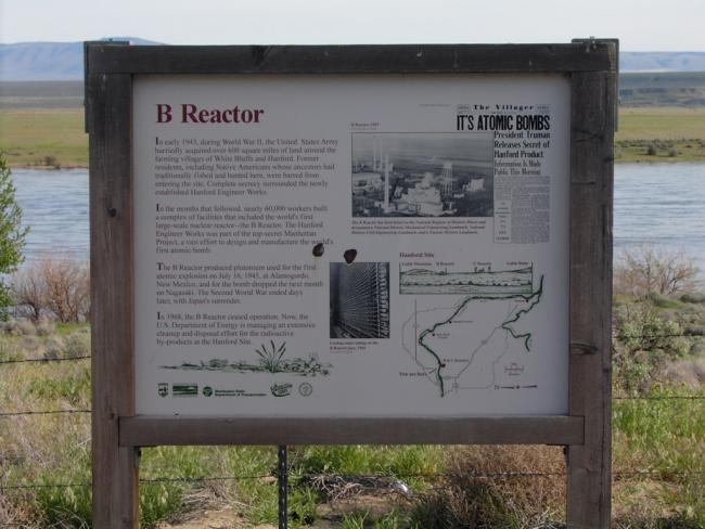
B-Reactor
Location: SR 24 Eastbound 1/2 mile west of junction of SR 240 and Sr 243
Marker 47
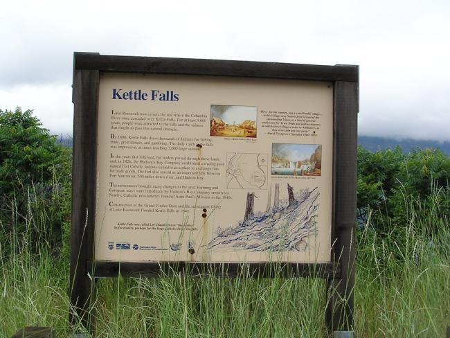
Kettle Falls
Location: SR 25 Northbound about 2 miles north of the junction of US 395 near Kettle Falls
Marker 48
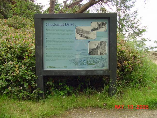
Chuckanut Drive
Location: SR 11 Southbound about 6 miles south of Bellingham
Scenic Byway: Chuckanut Drive
Marker 49
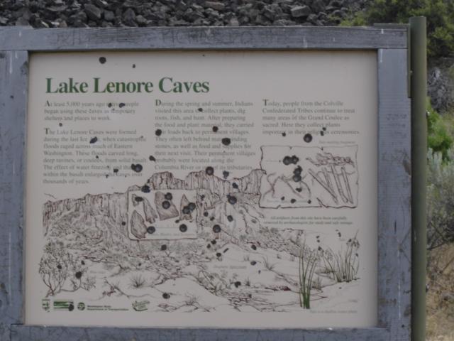
Lake Lenore Caves
Location: SR 17 Northbound in Lake Lenore Caves State Park about 8-1/2 miles north of Soap Lake
Scenic Byway: Coulee Corridor
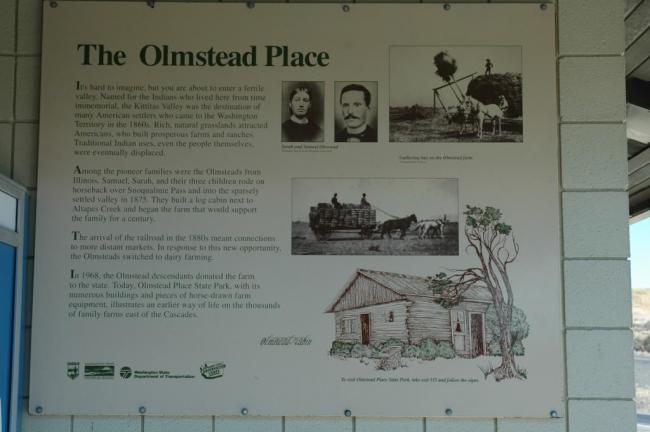
Marker 50
Olmstead Place
Location: I-90 Westbound in the Ryegrass Safety Rest Area about 15 miles east of Ellensburg
Marker 51
Railroads of the West
Location: I-90 Eastbound in the Sprague Safety Rest Area about 13 miles west of Sprague
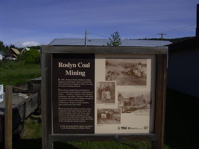
Marker 52
Roslyn Coal Mining
Location: SR 903 Next to Roslyn Museum
Scenic Byway: Mountains to Sound Greenway
Marker 53
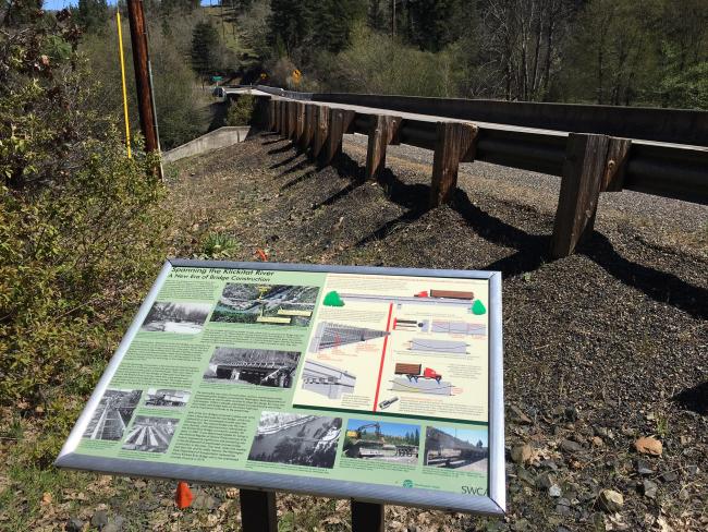
Klickitat River Bridge
Location: SR 142 Westbound on the bank of the west channel of the Klickitat River at Mile Post 17.5
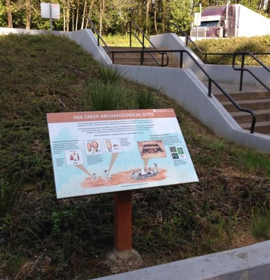
Marker 54
Gee Creek
Location: I-5 Southbound at the Gee Creek Rest Area near Mile Post 13
Marker 55
Patterson Swale
Location: SR 502 Westbound near Mile Post 3.3
Slow down – lives are on the line.
Excessive speed was a top cause of work zone collisions in 2024.
Phone down, eyes up.
Work zones need our undivided attention.
It's in EVERYONE’S best interest.
96% of people hurt in work zones are drivers, their passengers or passing pedestrians, not just our road crews.