Planning study news
WSDOT and the Yakama Nation are working collaboratively on the Heritage Connectivity (HCT) – Phase 1 Study. This phase will study options for a multi-use path along the US 97 corridor between the Toppenish vicinity and Union Gap to improve pedestrian safety, multi-modal transportation, and community connections.
Purpose
NEW! Take the Heritage Connectivity Trails survey to help us prioritize pathway options.
The Heritage Connectivity Trails – Phase 1 Study will develop multi-use path connectivity options for pedestrians, bicyclists, non-motorized rolling, and equestrian travel in key, priority locations and areas of concern identified by the Yakama Nation, local communities, and WSDOT. The HCT Project builds upon the regional coordination, planning efforts, safety analysis, and improvements in the US 97 corridor that began in 2017. These efforts focus on addressing priorities in support of re-connecting cultural, spatial, and recreational areas, and improving access to jobs, schools, and services while reducing the potential for vehicle and pedestrian crashes.
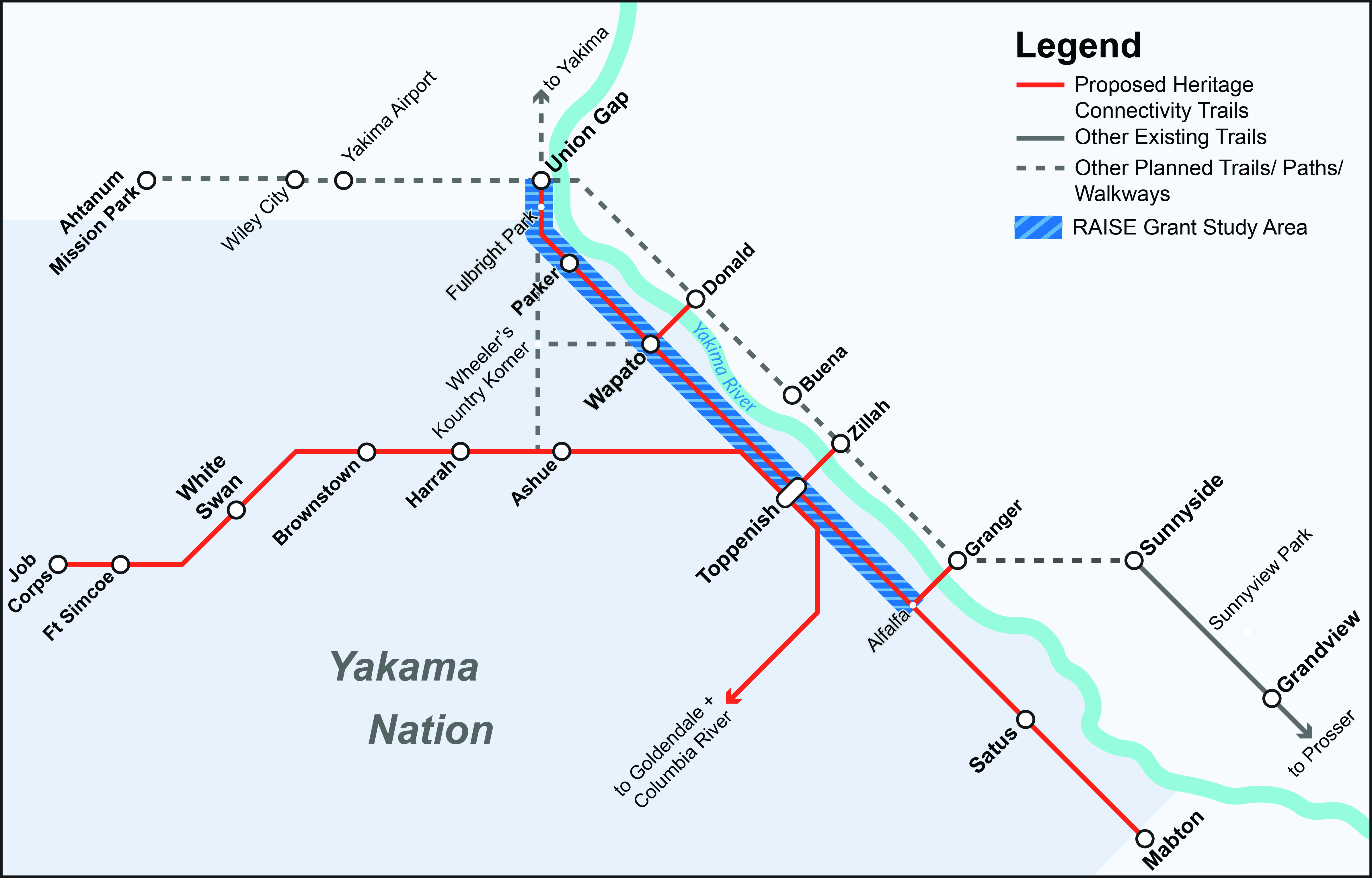
The Heritage Connectivity Trails – Phase 1 Study is a multi-agency cooperative effort with representatives from the Yakama Nation along with WSDOT, Washington Traffic Safety Commission (WTSC), Yakima County, Yakima Health District, Eastern Washington University (EWU), Yakima Valley Conference of Governments (YVCOG), and the National Park Service (NPS). These organizations recognize the need for improving pedestrian safety, multi-modal transportation opportunities, connecting communities, and broadening the regional trail system. A clear goal for the HCT is to connect existing partner plans, policies, and projects to create a seamless experience for future users of the HCT network. The Phase 1 Study covers approximately 23 miles along the US 97 corridor and is part of a larger project that is expected to create over 150 miles of multi-use paths in the lower Yakima Valley on Yakama Nation land.