Planning study news
On May 14, 2024, we announced the name of the new trail. It will be called the spuyaləpabš Trail, honoring the people who have lived on and stewarded the land for centuries: the Puyallup People. spuyaləpabš is the Lushootseed name for the Puyallup People, translated as "people from the bend at the bottom of the river." Lushootseed is the native language of 13 Pacific Northwest tribes, including the Puyallup Tribe of Indians.
Preliminary engineering, environmental analysis and cost estimation work is complete along with the final route of the new regional trail.
Purpose
The spuyaləpabš Trail, formerly referred to as the Tacoma to Puyallup Regional Trail, will be a 12-mile regional shared use path that connects downtown Puyallup to Fife and downtown Tacoma. It will provide people who live and work in the area with a new option to travel without a motorized vehicle to a variety of destinations. Through this study, WSDOT completed preliminary trail design, established trail character, prepared construction cost estimations and the environmental review.
WSDOT's SR 167 Completion Project led the study in coordination with the Puyallup Tribe of Indians, Pierce County, the Port of Tacoma, the cities of Tacoma, Fife and Puyallup, and other local cities and agencies. Through the study, WSDOT and partners finalized the trail route, completed preliminary trail design, prepared construction cost estimates and began the environmental review. WSDOT will build approximately 8 miles of the trail, with the remaining 4 miles built by the cities of Fife and Tacoma.
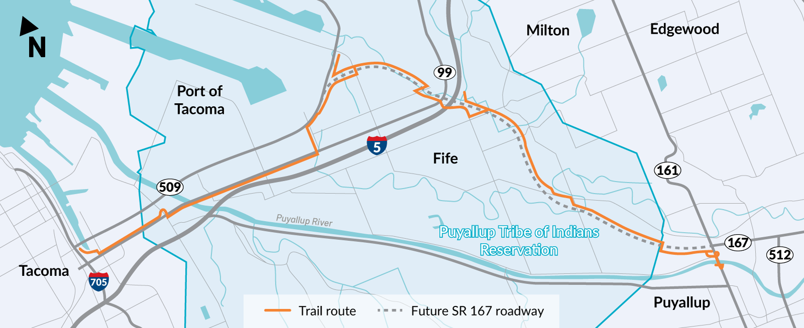
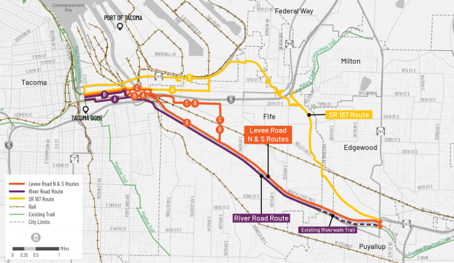
In 2019, an advisory group of local elected officials and community leaders launched the Tacoma to Puyallup Regional Trail Connection Route Analysis Study. The study evaluated three potential trail routes (Levee Road, River Road and the new SR 167 alignment) for safety, connections, accessibility, equity and other factors. In February 2020, the advisory group selected the future SR 167 corridor as the preferred alignment for the new trail. Learn more in the Tacoma to Puyallup Regional Trail Route Analysis Study Report (PDF 8.2MB).
parallels the new SR 167 alignment, shows the preferred route.
In 2021, the Washington State Legislature provided funding for the planning phase of trail work, including preliminary engineering and environmental review. In March 2022, the Legislature reserved $35.5 million for future trail construction. In July 2022, the trail advisory group, with input from the public, selected a preferred route to connect Fife to downtown Tacoma, finalizing the full trail route. In 2023, the Puyallup Tribe of Indians recommended spuyaləpabš Trail as the name, which was endorsed by study partners.