Planning study news
West Plains Subarea Transportation Management Plan Study, Phase 1, US 2 Vicinity
Purpose
The US 2 West Plains Sub-area Management Plan Phase 1, refines previous studies that have been completed in the West Plains area. This "live" study addresses the mobility gaps (congestion) that have already been identified along this 8-mile, east-west corridor between the US 2/ I-90 interchange junction and Fairchild Air Force Base entrance. The study incorporates Practical Solutions Strategies, in collaboration with the Technical Advisory Team, to improve mobility in and around the US 2 corridor for all users. The study is ongoing and will be updated as new information is available.
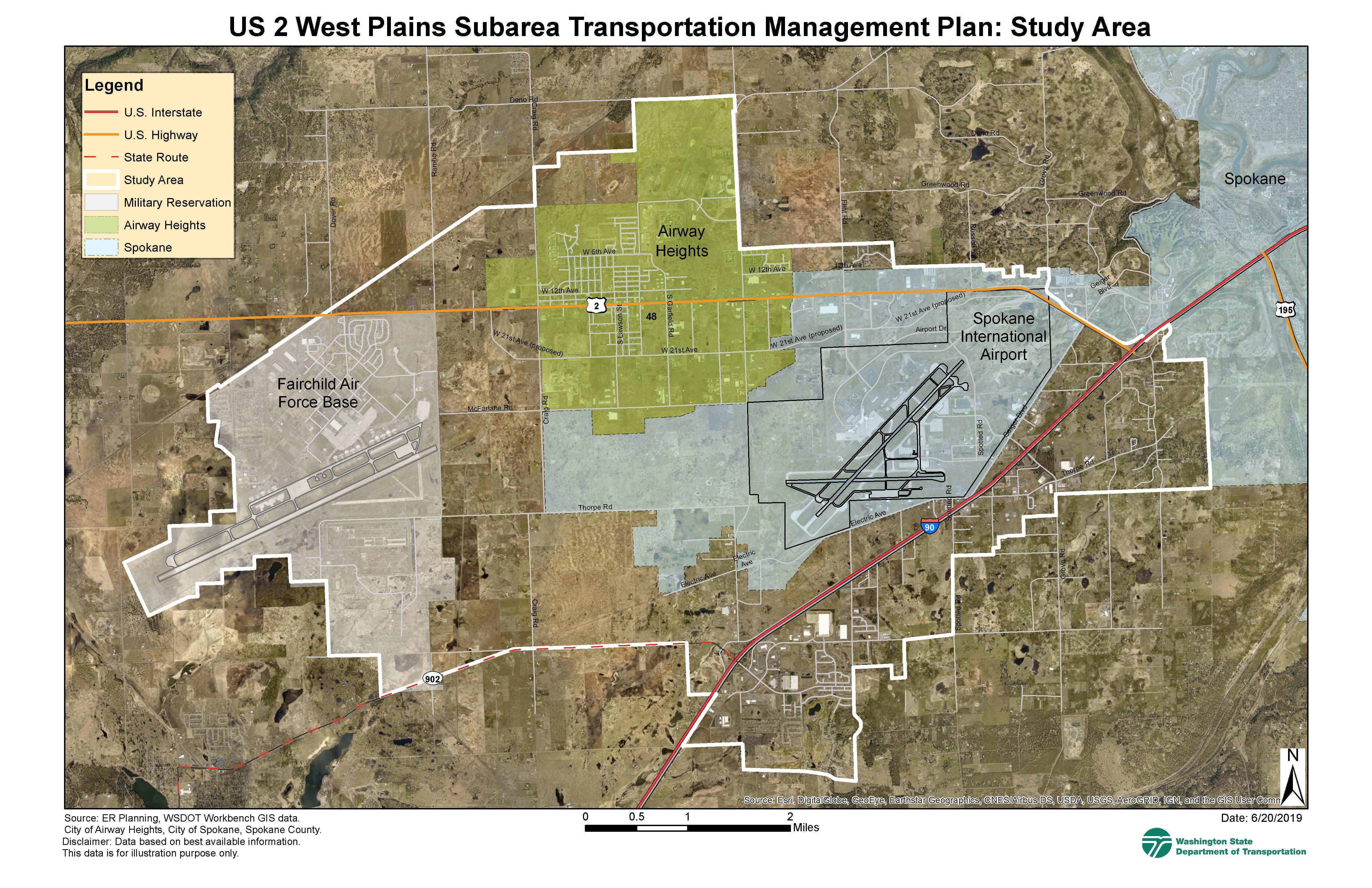
The West Plains Subarea Transportation Management Plan study area includes multiple jurisdictions: the cities of Airway Heights and Spokane, Spokane County, Spokane Tribal lands, Kalispel Tribal lands, Fairchild Air Force Base, and the Spokane International Airport. The primary east-west routes in this area are US 2 and Interstate 90 (I-90). The primary north-south routes are: Rambo, Craig, Hayford, and Spotted roads. See the map on the top right corner for the study area limits.
The West Plains Subarea Transportation Management Plan will:
- Refine past studies.
- Evaluate current and future land use and transportation conditions.
- Propose “practical solution” strategies that will provide for the evolving transportation needs.
See purpose and need statement as developed in collaboration with our regional partners: West Plains Subarea Management Plan – Phase 1, US 2 Vicinity “Purpose and Need” (PDF 646KB)
A mobility assessment was performed by WSDOT during the Corridor Sketch Initiative (2018) identifying congestion along the US 2 corridor. This area is rapidly developing and traffic is expected to continue to increase with planned land use developments. This study includes a market land use analysis forecast, that includes land use expected to occur before the year 2040. Also, part of this study identifies future parallel roadways (6th/10th/12th and 18th/21st avenues) to provide alternative routes for local trips, helping to improve mobility in and around the US 2 corridor.
For full study details and ongoing study efforts see:
West Plains Subarea Transportation Management Plan